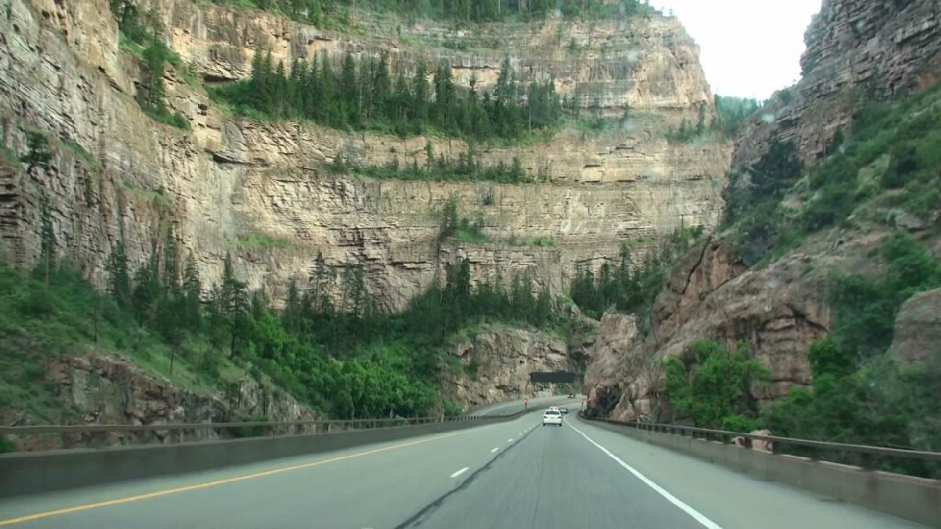
Take A Scenic Drive Through Glenwood Canyon, Colorado
Whether you’re visiting the Glenwood Springs area or just passing through the area on Interstate 70, the 12.5-mile stretch of interstate that passes through Glenwood Canyon will give you some dramatic views carved by the power of the Colorado River over three million years.
This stretch of highway between the towns of Dotsero and Glenwood Springs has historically been a treacherous route to drive, and although there can still be hazards, the award-winning highway construction that was completed in 1992 has greatly improved traveler safety through the canyon.

The canyon highway improvements were designed to preserve and protect the natural environment and beauty of the canyon while mitigating hazards like flooding, rockfall, and extreme curvature of the highway.
Traveling through the canyon will take you over 40 bridges and through two tunnels as you wind your way viewing canyon walls that exceed 1,300 feet high.
What you may not see are the 800,00+ tons of concrete, 30,000 tons of structural and reinforcing steel, 15 miles of protective retaining walls, and the traffic management facility hidden within the ground at the Hanging Lakes tunnel that monitors real-time traffic movement and can allow response to emergencies from within the tunnel. The engineering and construction of this section of road are truly impressive and has earned over 30 awards.
In addition to providing safer traveler access, the Glenwood Canyon offers a host of recreational opportunities. Picnicking, hiking, biking, fishing, kayaking, whitewater rafting, and wildlife viewing are all available through the canyon, giving explorers a decidedly different perspective on the beauty of the river and canyon. Wildlife including bighorn sheep, bears, deer, mountain lions, marmots, and numerous birds can be found in the canyon.
The historic Shoshone Power Plant is located near the Hanging Lake Tunnel and is visible from the highway. This is a hydroelectric power plant that uses the power of water to generate electricity, but at one time also included a small community.

The Shoshone Dam is actually located two miles upstream of the power plant and creates a still lake on the Colorado River. The power plant is considered an important historic structure, with history dating back to 1886 and construction completed in 1909.
In addition to supplying power, the power plant is critical for water management and water rights as well as the ecological health of the Colorado River by controlling water flow on the river for downstream use.
There are four rest areas through the canyon that provide access to the canyon as well as picnic areas, restrooms, and trash bins.
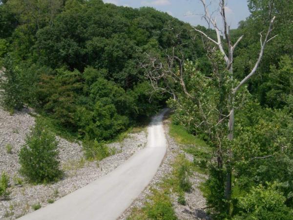
Bair Ranch Rest Area is the first Glenwood Canyon rest area for travelers coming from the east side of the canyon. Access to the river as well as to the paved 16.3-mile (one way) walking/bike trail that travels the entire length of the canyon can be found from this area. The parking area is tight, and vehicles longer than 35 feet may not be able to use this stop.
Hanging Lake Rest Area is closed to personal vehicles between May 1 and October 31. Hanging Lake was designated as a National Natural Landmark in 2011. The hike in to Hanging Lake is one of the most popular hikes in Colorado. It is a short (3.2 miles roundtrip), steep and rocky ascent to the shore of the travertine lake, created from dissolved limestone is deposited on rocks and logs in the lake. Natural waterfalls and spectacular views make the hike truly memorable.

The lake ecology is very fragile, and over-use (and abuse) of the beautiful area has caused the US Forest Service to enact a reservation system beginning in May 2019.
Those wishing to hike in to visit the lake during the prime season will need to make a reservation in advance and take a shuttle to the trailhead. This effort has been done to protect the lake and also enhance the hiking experience by limiting the number of visitors at any given time. Please help protect this beautiful spot by following the rules and hiking your trash back out of the area.
Grizzly Creek Rest Area contains a boat ramp for river access and is one of the more popular rest areas along the canyon. There are a number of experienced river guides who also launch trips from this area to take advantage of the Class IV and V rapids and riverside hot springs. Grizzly Creek Trail allows hikers access up Grizzly Creek, one of the tributaries to the Colorado River. The moderately difficult hiking trail is about 7 miles out and back.
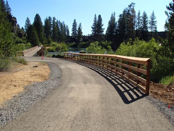
No Name Rest Area is the rest area closest to Glenwood Springs (only 3 miles east of town). The rest area provides access to the paved recreation path as well as river access for fishing and boating. Hikers can access the Jessie Weaver Trail that follows No Name Creek up one of the least-traveled side canyons in the Glenwood Canyon about a half mile north of the rest area. The trail is open for hiking and horseback riding and is a little over 7 miles out and back. In addition to the rest area, the Glenwood Canyon Resort is also located at this exit, providing RV camping spots as well as rafting, zip lining, and other adventures.
Exploring the Glenwood Canyon is well worth any traveler’s time. Each area gives a bit of a different view of the canyon and the scenic geography of the area, as well as an appreciation of the engineering challenges involved with getting a highway through a narrow canyon while preserving the natural wonders and sensitive ecology of the area.
See also: Explore Colorado’s Canyonlands Along Highway 141
The post Take A Scenic Drive Through Glenwood Canyon, Colorado appeared first on RV Life.
- Log in to post comments